About Us
We are here to help you find and develop your dream property.
There are a lot of questions that come with buying mountain property. From site access, utilities, build locations, and beyond we are here to help you find the perfect property and develop your lot to its full potential. We offer a wide range of services, all conducted by a professional Colorado civil engineer with years of experience in the land development field.
Why choose us
Whether you are a local Colorado resident looking for guidance in the property development process or an out of state resident looking for their mountain getaway we provide on-site analysis and imaging the help make sure you are buying a property that fits your ambitions.
We know it is difficult for those looking to buy property to make arrangements to visit sites, and what and where to look to identify the site limits and constraints once, and that is why we are there to help. We offer a number of services to give you clear and precise understanding of the property that goes beyond realtor photos or publicly available aerial imaging.
Our Process
Our inspection services begin prior to arriving at the property. Once the location is provided, the property research begins to determine property lines and corners, identify any city/county building or zoning restrictions, and existing utility information.
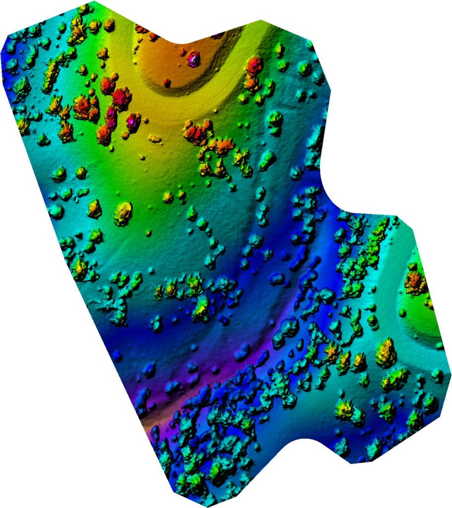
Upon arriving on site we will conduct a walk through of the property and note any specific terrain and vegetation features. We will proceed with aerial imaging of the area to provide you with the most current property data. Our process allows us to easily share high definition, up-to-date imagery of your property. We can provide you with multiple imaging options from over-head aerial imagery and videos, elevation and vegetation mapping, and even 3D models so you can re-visit every inch of the site without leaving your computer.
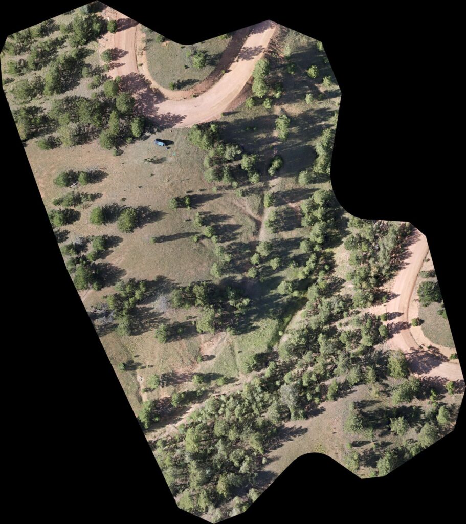
Using our 4K High definition camera, we will fly a grid over you entire property while taking hundreds of photos that will be stitched together to form one high-definition, zoomable photo. Combine this with elevation and vegetation maps and our 3D renderings and we provide you the ability to visit every inch of your property.
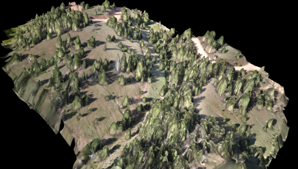
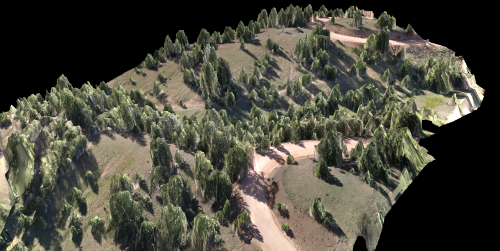
See the link below to see a 3D rendering of a site that we completed.
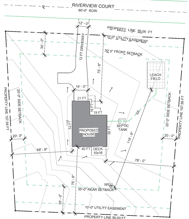
Let us help you prepare you site to build
Our structure of being a company owned and operated by a licensed Colorado Professional Engineer allows us to not only provide you with the imagery and site data but also the unique ability to create the required site plans for your property once you are prepared to build.
